I have a good view of the smoke column from Brentwood. I've also never seen a fire spread that fast. Same thing, in about an hour it went from a small fire to the smoke blocking out the sun.
As a testament to the speed of the winds, I've never seen a smoke column visually move so quickly. Usually at that size and distance, they feel more like static objects.
Edit: I'm preparing to evacuate tonight in case the order comes through. Checking the most recent maps, the fire has burned through almost all of the Palisades and is getting into Brentwood. The fire may also reach Santa Monica at this rate. I'm stacking go bags by the door.
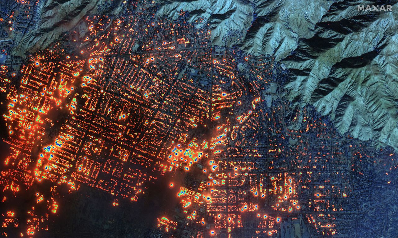
The resolution in the posted image is much better than satellite, however. This implies that it's an airborne platform like FIRIS (https://wifire.ucsd.edu/firis-in-depth). It also uses IR.
> IMPACTS...If fire ignition occurs, conditions are favorable for very rapid fire spread and extreme fire behavior, including long range spotting, which would threaten life and property. There will be a high risk for widespread downed trees and powerlines, as well as widespread power outages. A Red Flag Warning means that critical fire weather conditions are either occurring now, or will shortly. Use extreme caution with anything that can spark a wildfire.
As a testament to the speed of the winds, I've never seen a smoke column visually move so quickly. Usually at that size and distance, they feel more like static objects.
Edit: I'm preparing to evacuate tonight in case the order comes through. Checking the most recent maps, the fire has burned through almost all of the Palisades and is getting into Brentwood. The fire may also reach Santa Monica at this rate. I'm stacking go bags by the door.